The Wyoming chapter of the Society for Range Management (SRM) has announced the dates for their annual summer tour. Tickets and registration for the event can be found here.
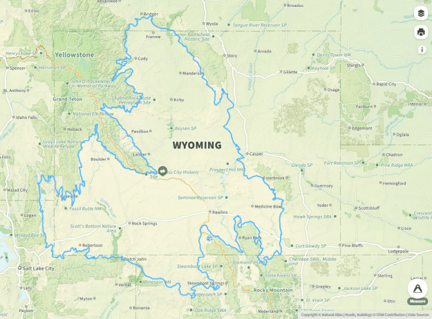
This year’s tour is in August in Casper, with stops in the Southern Thunder Basin (part of the Powder River Basin) and the Northern Shirley Basin.

Thunder Basin
The Thunder Basin, a sub-basin within the larger Powder River Basin, is home to the Thunder Basin National Grassland (TBNG). Thunder Basin is presumably named for the notable number of thunderstorms in the area. Another presumption, from late historian Velma Linford, is the area was named for Little Thunder Creek or Black Thunder Creek; those creeks were named for the thunder in the area. Nearby, close to the Montana line, the extinct community of Lightning Flat (or Lightning Flats on some older maps) was named for the noticeable frequency of lightning in the area. Like many states, Wyoming has varied placenames that range from literal to odd to whimsical.
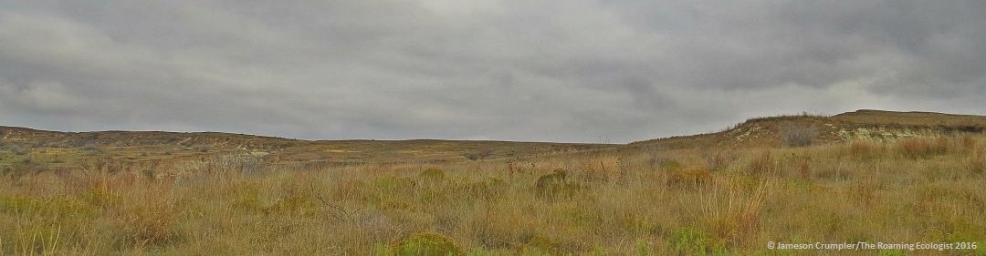
Viewed as an ecoregion, the Powder River Basin contains much broken country along the Powder, Cheyenne, and North Platte Rivers and their many tributaries. This broken country is known as “breaks.” Breaks are simply landscapes that are cut by rivers and creeks and other flowing bodies of water, and are often adjacent to level or rolling plains.

The Powder River and associated breaks. Photo taken on Upper Powder River Rd. south of Arvada. The town of Arvada is near the point where the Upper Powder River transitions to the Lower Powder River as it winds along its final leg to the Yellowstone River near Blatchford, Montana.
Coal mining and cattle ranching are the primary land uses in the Powder River Basin. The Powder River coal mines produce more coal than any other coal-producing region in the US, including Appalachia. Some 16 mines produce about 43% of the total US coal production. The second highest-producing of the 16 mines is called the Black Thunder Mine, a nod to the Thunder Basin.
In retrospect, perhaps Wyoming should have been called the “Coal State,” but that wouldn’t fit with the well-deserved cowboy image, nor the rugged individual myth-building of the American West. Mule deer, pronghorn antelope, and sage grouse roam the relatively wide-open plains. Some non-migrating populations of Bald eagles often overwinter in the Powder River Basin, and wild turkeys are present along the river bottoms.
Shirley Basin
Located between the Granite Mountains and the Laramie Mountains, south of Bates Hole and north of Medicine Bow is one of the smallest geologic basins in Wyoming. The Shirley Basin, (not the former company town of the same name), was named for the Shirley Mountains, and those mountains were named for an area freighter by the name of John Shirley. Like the Powder River Country, the Shirley Basin has a cold semi-arid steppe climate–winters are long and cold, summers are short and hot; however, the Shirley Basin is colder and drier than the Powder River Country because the Shirley Basin is around 7,000′ elevation, whereas the Powder River Country ranges between 3,500-5,000′ elevation.
The Shirley Basin is another energy extraction basin. Uranium was mined in the Shirley Basin from about 1959 to 1992. Ur-Energy and Noble Plains Uranium Corp. each plan to resume uranium mining operations at Shirley Basin sometime in 2025-2026. Elsewhere in the Shirley Basin region, livestock ranching (cattle and sheep), and other energy industries are the primary land uses. The Shirley Basin, a sub-basin of the Wyoming Basin, is located within the Rolling Sagebrush Steppe ecoregion.
One of the two largest intact remaining grasslands in North America is in Wyoming: the Wyoming Basin. This grassland is also the largest intact desert grassland region in North America and contains about 55% of the remaining habitat critical for the long-term viability of Sagebrush (Artemisia spp.) species. Additionally, the Wyoming Basin grasslands are home to the greatest length and largest scale of migratory pathways for the pronghorn (Antilocapra americana) and greater sage-grouse (Centrocercus urophasianus). Without this expansive and intact grassland, those two iconic species would likely go extinct, along with numerous other wildlife and plant species, and the livelihood of the Western cowboy would be impacted.